Area Day Trip Options
Southern Utah is a beautiful, scenic area filled with mountain lakes, streams, red cliffs, mountain peaks, deep canyon, gorges, hiking, biking, and more. Our suggestions include several one-day trips to a variety of nearby destinations to match every taste. We invite you to stay multiple days at the Aquarius Inn in Bicknell, Utah, and enjoy our spacious rooms, pool and spa while you explore and discover the range of experiences available in and around Capitol Reef National Park.
Enjoy the Beautiful Loops
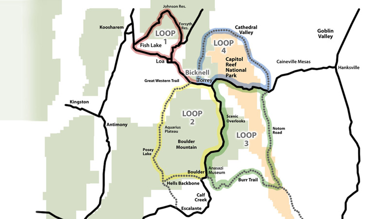
Loop 1
Fish Lake Area
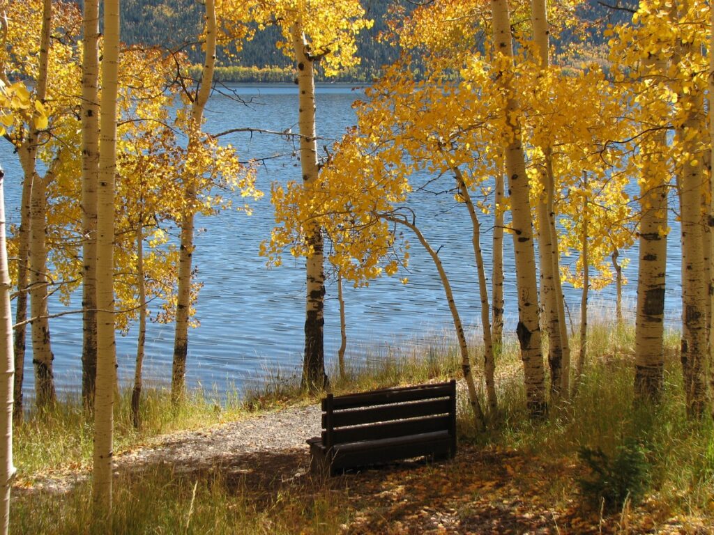
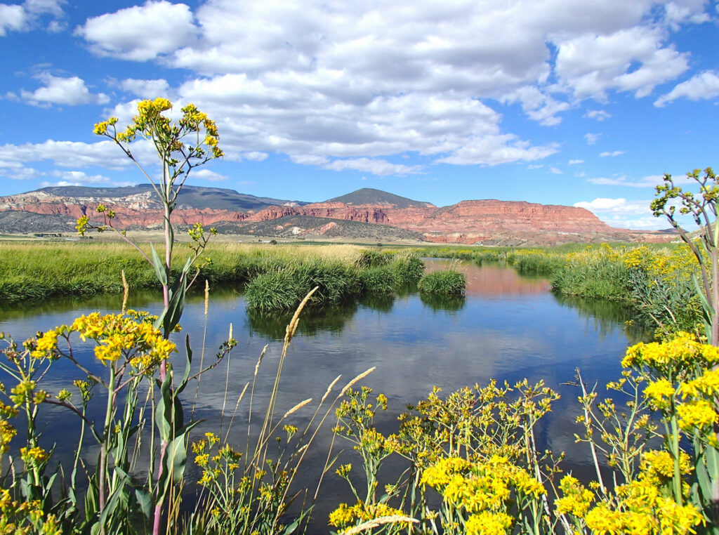
The deep blue body known as Fish Lake, Utah, is cradled by lofty mountains clothed with a thick blanket of Aspen giving way to green of the pines on higher slopes—a breathtaking sight just off highway 24 traveling on Route 25. Fish Lake offers some of the best fishing for trout, splake and huge mackinaw. Making the scenic loop, Route 25 winds its way around Fish Lake to Johnson Reservoir and past slopes of black volcanic rock. Here the Fremont River heads and makes its way through Johnson Valley where its cool, clear waters offer great fishing. The river flows into Mill Meadows reservoir which also offers boating and fishing.
Loop 2
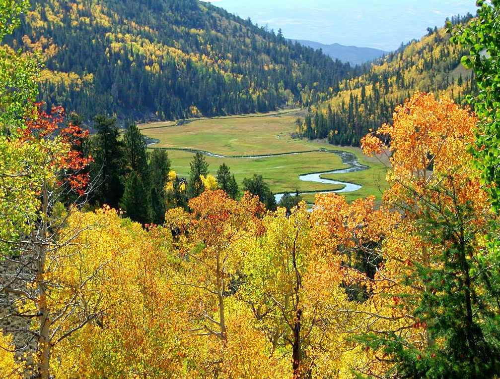
Scenic Byway 12 & Boulder Mountain
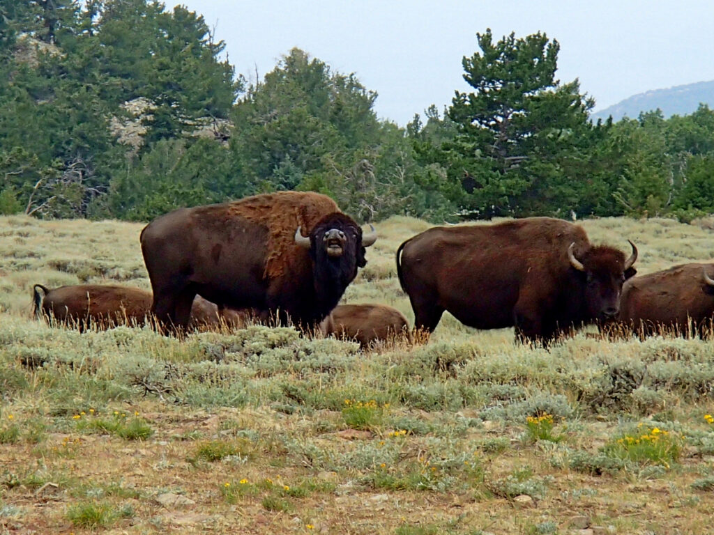
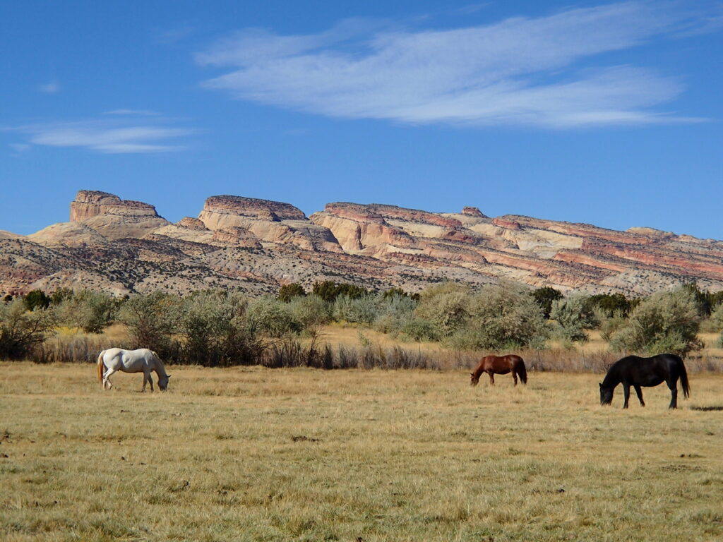
Scenic Byway 12 breaks off of Route 24 just east of Aquarius Inn from Torrey and is one of only 20 American highways to be dubbed an “All-American Highway”. Highway 12 is ranked the second most scenic route in the nation. The road runs north-south, parallel to Capitol Reef National Park, dipping and climbing its way around the east end of Boulder Mountain through shimmering green groves of quaking aspen and the evergreen of pines. This is an especially beautiful drive in the fall when the brilliant green of the aspen turn to gilded gold and fiery red. Scenic lookouts are marked and paved. From these vantage points you can see (on a clear day) hundreds of miles. The red and white cliffs of Capitol Reef, the pigeon blue of the clay mesas of Caineville and the lofty, blue peaks of the Henry Mountains, where one of the last free-roaming herd of buffalo graze.
Hells Backbone
For the adventurous off-roader, the loop continues on a graveled road across the narrow and breath-taking spine of Hell’s Backbone. From there it runs west, climbing halfway up Boulder Mountain to connect with the Posey Lake/Pine Creek Road. That road comes north of out the town of Escalante, allowing travelers to complete a 38-mile loop back down to Hwy 12. The Hells Backbone Road is one of the most scenic back-ways in Utah. In one area it follows a narrow hogs-back with sheer drops to both the right and the left. It is steep in spots and it can be treacherous during stormy weather.
Loop 3
Scenic Byway 12, Anasazi Museum, Burr Trail & Highway 24
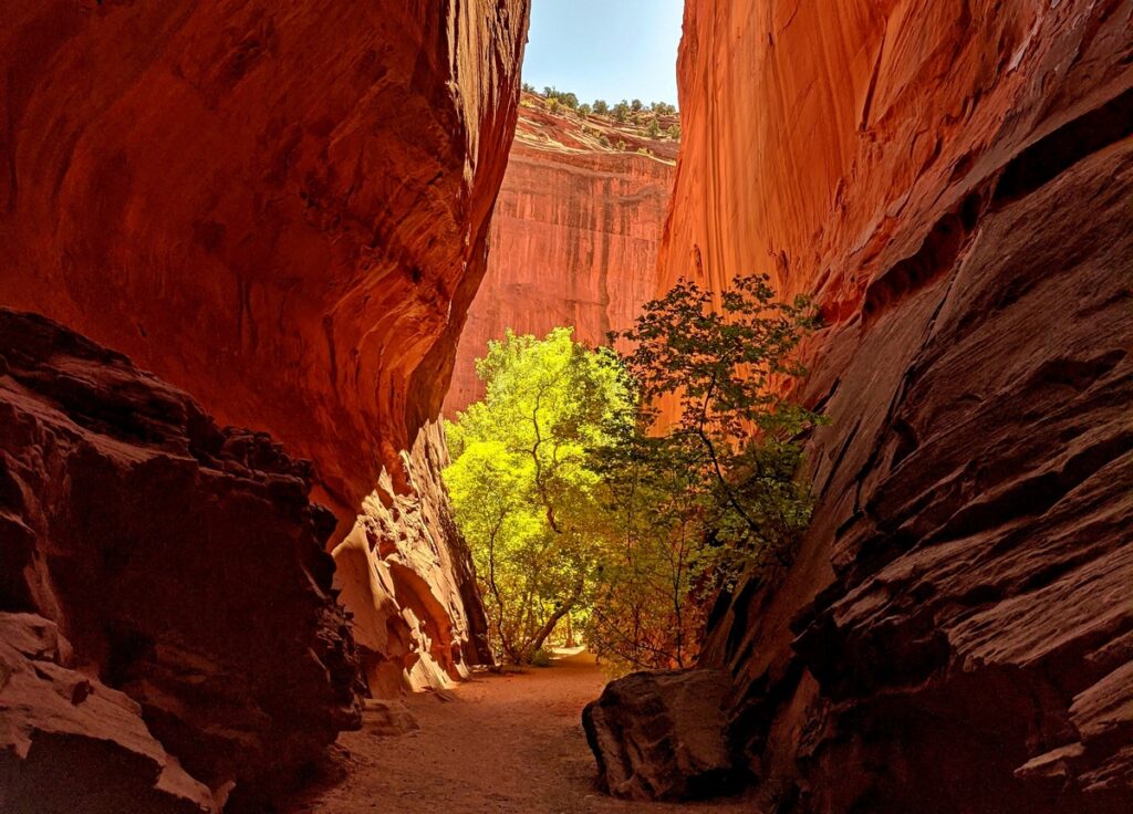
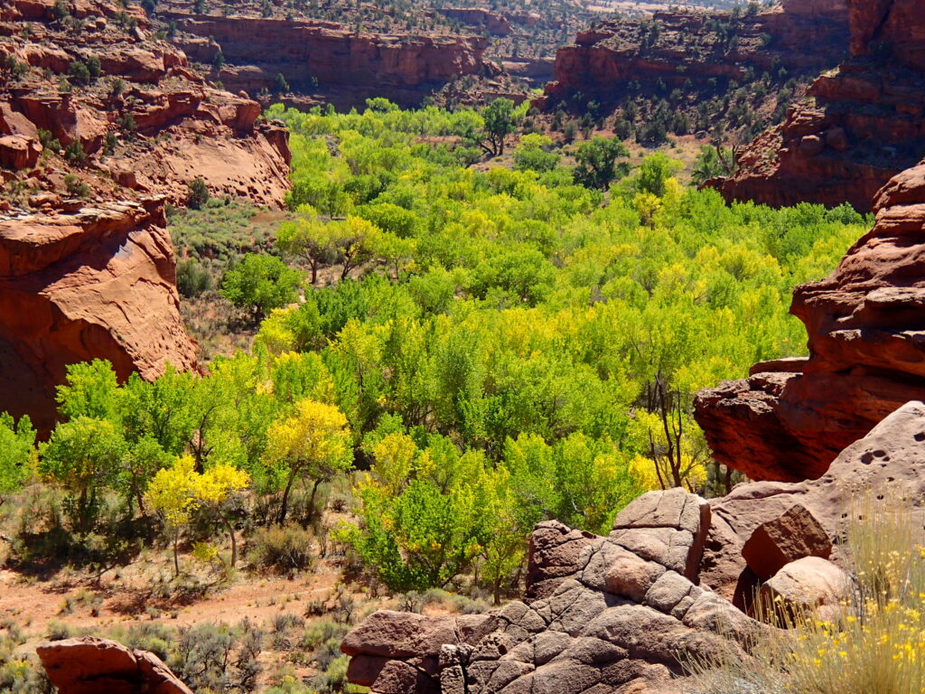
After driving across Scenic Byway 12 across the Boulder top and stopping in Boulder at the Anasazi Museum, you can take the Burr Trail drive from Boulder which takes you down a steep switchback that hangs on the edge of red cliffs and down through Long Canyon – a cool shadowed cliff-lined road which is now paved all the way to Highway 24. Stop for a hike into the small box canyon along the side of the road before you leave Long Canyon – it’s beautiful and a short walk. Take the paved road through Notom back to Highway 24 and travel through Capitol Reef National Park. As you travel West on Route 24, observe the remnants and feel the spirit of those hardy pioneers who settled and made this their home. With each journey through this special place, called Capitol Reef, new pleasures meet the eye. A different rock formation, a different blend of colors – Mother Nature uses all to sculptor and paint her masterpieces.
Anasazi State Museum
The Anasazi State Museum and partially excavated prehistoric Native American village is located in the heart of the small picturesque town of Boulder, which sits amidst green fields and hills of white quilted rock. These ruins were once the site of one of the largest Anasazi communities west of the Colorado River and served as a hub of Anasazi culture. Experts believe that Anasazi occupied the village between 1050 and 1200 A.D. You can visit the museum year-round, where artifacts from this ancient culture are displayed.
Loop 4
Capitol Reef National Park
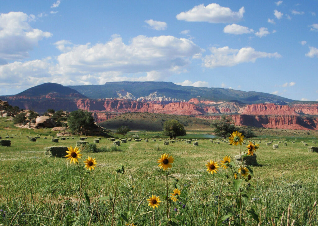
Utah’s Capitol Reef National Park is a 70 mile long fold in the earth’s crust. The area is referred to as the Waterpocket Fold and features an astounding array of rock formations. Hiking trails are abundant and roads lead through and around the park. Before you start your Capitol Reef adventure, stop at the Visitors’ Center just east of Torrey, Utah on Highway 24. There a short film is shown on the points of interest and history of the park.
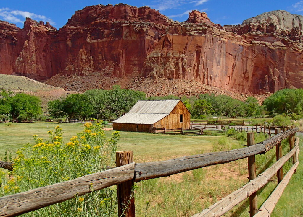
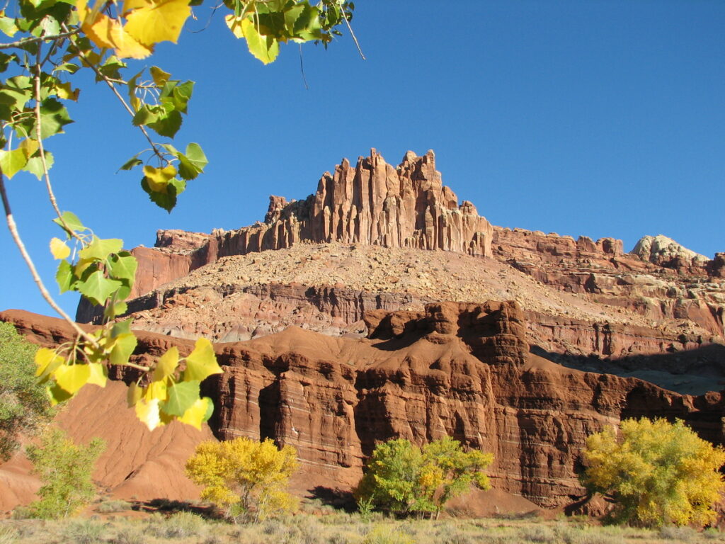
Entering Capitol Reef National Park from the west on Highway 24, you will view many sculptured wonders, including Castle Rock. The Castle sits high atop its foundation of red rock of varying shades and looks down on the green of fruit trees, a reminder of the hardy pioneers who settled the little town of Fruita.
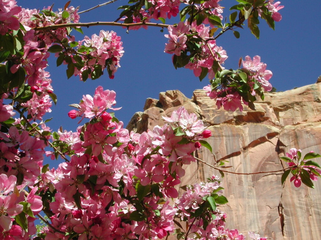
The trees, both in bloom and bearing ripened fruit, are a special attraction of the park. When in season, cherries, apricots, peaches, pears and apples can be picked by the pound. Deer live and are protected in Capital Reef and the fruit is a special attraction to them also.
Don’t miss the schoolhouse. With the push of a button you can listen to the voice of the teacher who taught those long ago pupils, telling about the days of education in this tiny one room house of learning. View the desks, inkwells and chalkboard. Take a walk along the boardwalk and view another chalkboard… this one made of red sandstone and used by the ancient Indians.
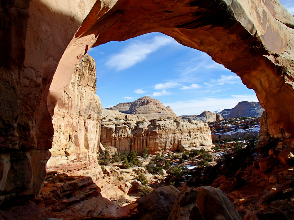
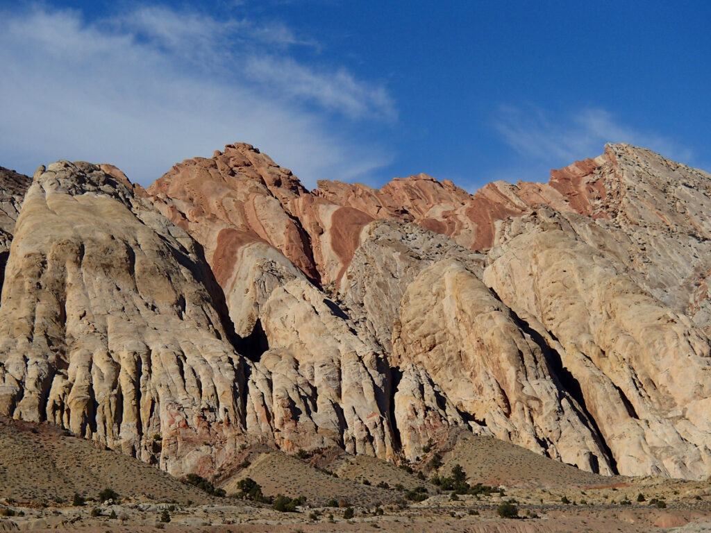
Capitol Reef is a red sandstone masterpiece created by erosion over millions of years. The beauty of its formations and multicolored cliffs such as Chimney Rock, Capitol Dome and Hickman Bridge give the visitor just a small peek at some of Capitol Reef’s natural beauty and colorful handiwork.
If your plans are only of the park, take another hour and make a round trip into Caineville. The fiery red of the Reef changes to pigeon blue of clay mesas. Highway 24 twists and flows with the Fremont River by its side, through the park and there is no charge to travel this scenic part of Utah.
Cathedral Valley
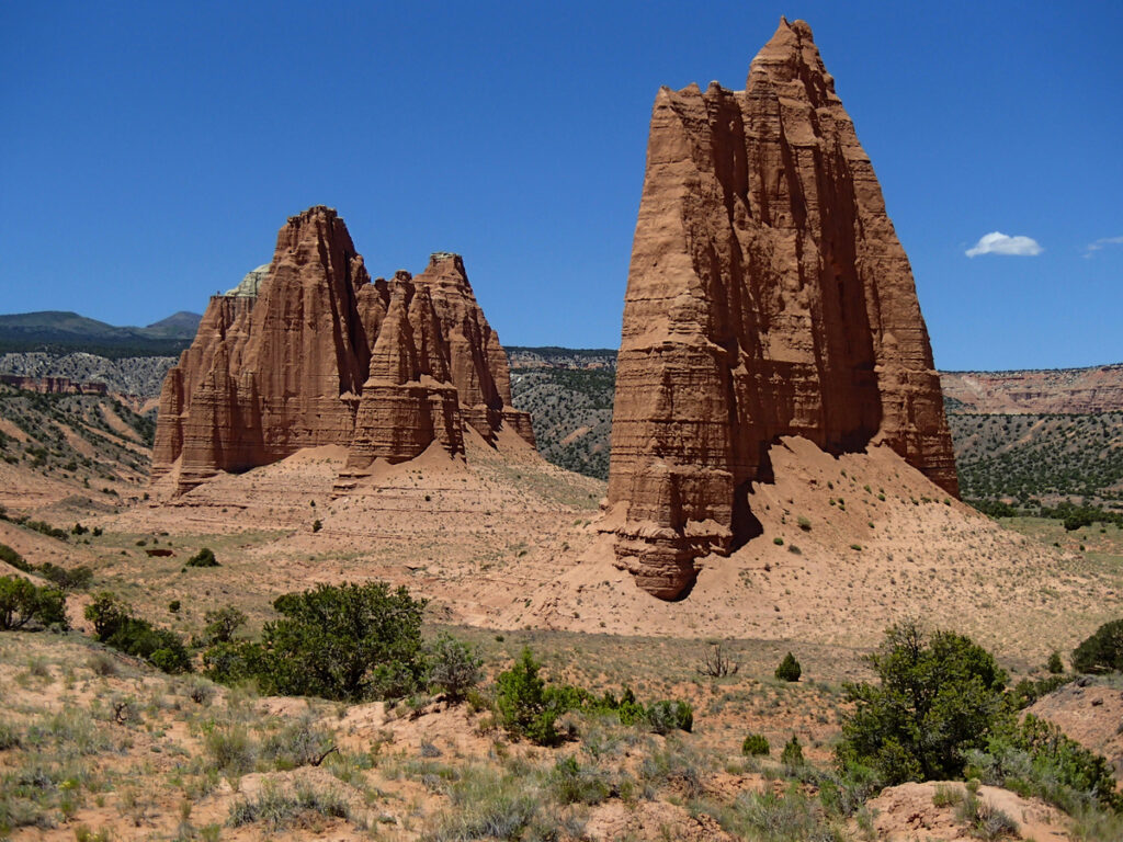
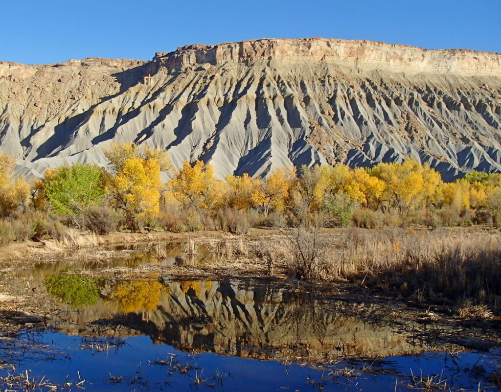
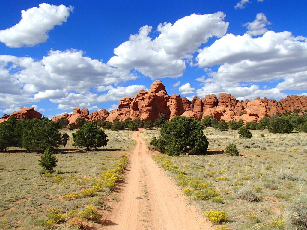
Cathedral Valley is the loop to take when the thirst for solitude and beauty is your guide and dust, mud, heat or cold is your traveling companion. It’s a remote and isolated corner of Capitol Reef National Park where few venture. Massive rock formations shoot skyward from the desert floor to heights of hundreds of feet. Their names suggest mysterious and exotic places: Temple of the Sun, Temple of the Moon and The Wall of Jericho. Their colors are an ever-changing parade of tan, buff and red sandstone; the windswept clouds and sun being the grand marshal, shading, blending and changing the majestic monoliths.
Explore The 59 Mile Loop
Days could be spent hiking and exploring the many canyons and monoliths in Cathedral Valley. A high clearance vehicle is recommended as is carrying plenty of water, food and gas. The 59 mile loop through Cathedral Valley starts East of the park boundary off Hwy 24 at River Ford. Crossing the Fremont River is usually very shallow except during summer run off and periods of flooding (check at the Visitors Center for conditions of the river and the valley). The route follows Hartnet Road, taking you to a fork allowing you to continue traveling West on the Polk Creek Road across Thousand Lake Mountain to connect with Hwy 72 (giving a panoramic view of the desert and Cathedral Valley) or continue the 59 mile loop by following Caineville Wash Road to return back to Hwy 24, just West of Caineville. No matter which route you choose to see the Valley of the Cathedrals, don’t forget the camera. The Valley awaits the photographer, both amateur and professional.
ATV/Off-Road
Great Western Trail
The Great Western Trail spans 4,455 miles through 5 states. 1,600 miles are in Utah. Located approximately two miles east of the Aquarius Inn on the North side of U-24 is a map of the Great Western Trail in our area. For a spectacular and thrilling ride try the Velvet Ridge Trail. From high atop the Red Ledges you have a panoramic view of the valley below and South to the Boulder Mountain, East to the Henry Mountains and North to Thousand Lake Mountain. Miles of beautiful ATV or dirt bike adventure awaits you.
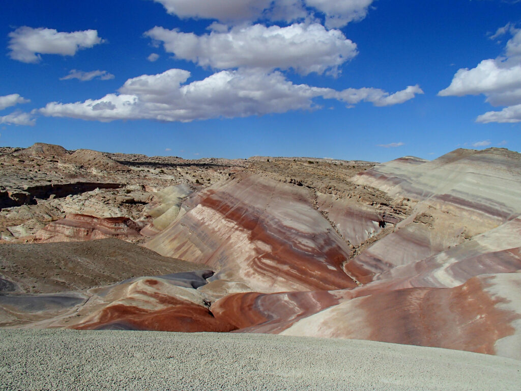
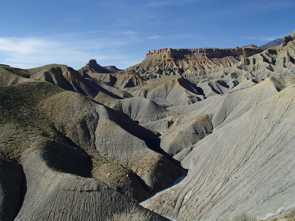
Caineville Mesas
Traveling 40 miles East on Hwy. 24 from the Aquarius Inn will get you to the blue clay hills of Caineville – a paradise of hills and valleys just waiting for ATV and dirt bike enthusiasts. These same hills provided fun and entertainment for children of all ages since the early settlers. Now the fun comes with wheels. The steep clay hillsides are bare of vegetation and rocks are practically non-existing thus providing the best riding possible. Professional and amateur riders alike can appreciate the challenge and the thrill of making the top. Freestyle motocross riders have been filmed here and know well the name Caineville. So for a day of family fun, bring the little kids, the big kids and the in between kids because there is a hill to match the wild side of everyone.